Направо към съдържанието

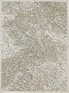
Файл:Kragujevac - 39-44.jpg

Съдържанието на страницата не се поддържа на други езици.
от Уикипедия, свободната енциклопедия

Оригинален файл (3657 × 4949 пиксела, големина на файла: 4,98 МБ, MIME-тип: image/jpeg)

Емблемата на Общомедия Този файл е от Общомедия и може да се използва от други проекти.

Следва информация за файла, достъпна през оригиналната му описателна страница.

38° 39° 40°
45° 45°
44° 44°
43° 43°
38° 39° 40°
Deutsch: Blatt 39-44 der Generalkarte von Mitteleuropa 1:200.000 der Franzisco-Josephinischen Landesaufnahme, Österreich-Ungarn, ab 1887. Die Blattmitte liegt bei 44° n.Br. und 39° ö.L. (östlich von Ferro, nicht Greenwich!).

English: Sheet 39-44 of the General Map of Central Europe, scale 1:200,000, edited 1887 ff. See 3rd Military Mapping Survey of Austria-Hungary for details. The center of the sheet is 44° North, 39° East (east of Ferro, not Greenwich!).

Übersicht / Overview
Übersichtskarte
Overview map

Nachbarblätter. Klicken Sie auf eine Miniatur, um zu diesem Blatt zu gelangen.
Neighbouring sheets. Click thumbnail to navigate

Резюме

Описание 3rd Military Mapping Survey of Austria-Hungary - Kragujevac
Дата
Източник http://lazarus.elte.hu/hun/moterkep.htm - László ZENTAI
Автор Military mapping authority of Austria-Hungary

Лицензиране

Public domain

Това произведение е обществено достояние в държавите, в които срокът на авторското право е 70 години или по-малко след смъртта на автора.


You must also include a United States public domain tag to indicate why this work is in the public domain in the United States.
This file has been identified as being free of known restrictions under copyright law, including all related and neighboring rights.

Описания

Add a one-line explanation of what this file represents

Items portrayed in this file

изобразен обект

История на файла

Избирането на дата/час ще покаже как е изглеждал файлът към онзи момент.

Дата/ЧасМиникартинкаРазмерПотребителКоментар
текуща13:00, 7 август 2007Миникартинка на версията към 13:00, 7 август 20073657 × 4949 (4,98 МБ)Szilas== Összefoglaló == {{Information |Description = 3rd Military Mapping Survey of Austria-Hungary - Kragujevac |Source = http://lazarus.elte.hu/hun/moterkep.htm - László ZENTAI |Date = 1912 |Author = Military mapping authority of Austria-Hungary |Permiss

Следната страница използва следния файл:

Глобално използване на файл

Този файл се използва от следните други уикита:

Метаданни