
Файл:Blank Map World Secondary Political Divisions.svg

Размер на този PNG предварителен преглед на изходния SVG файл: 512 × 260 пиксела. Други разделителни способности: 320 × 163 пиксела | 640 × 325 пиксела | 1024 × 520 пиксела | 1280 × 650 пиксела | 2560 × 1300 пиксела.
Оригинален файл (Файл във формат SVG, основен размер: 512 × 260 пиксела, големина на файла: 2,38 МБ)
| Този файл е от Общомедия и може да се използва от други проекти.
Следва информация за файла, достъпна през оригиналната му описателна страница. |
Резюме
| Описание |
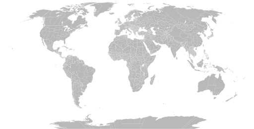
English: A detailed Robinson projection SVG map of the world with secondary political units grouped for easy coloring. |
| Дата | |
| Източник | |
| Автор |
|
Лицензиране
Аз, носителят на авторските права над тази творба, я публикувам тук под следния лиценз:
| Този файл е достъпен под лиценза Creative Commons CC0 1.0 Универсален Посвещение на публичните домейни. | |
| The person who associated a work with this deed has dedicated the work to the public domain by waiving all of their rights to the work worldwide under copyright law, including all related and neighboring rights, to the extent allowed by law. You can copy, modify, distribute and perform the work, even for commercial purposes, all without asking permission.
|
История на файла
Избирането на дата/час ще покаже как е изглеждал файлът към онзи момент.
| Дата/Час | Миникартинка | Размер | Потребител | Коментар | |
|---|---|---|---|---|---|
| текуща | 03:22, 28 юни 2024 | | 512 × 260 (2,38 МБ) | ClaveScottPH | Fixed Greenland, some overlapping subdivisions, and others. Added subdivisions for Fiji, Malta, São Tomé and Príncipe, and Trinidad & Tobago. |
| 08:02, 25 юни 2024 |  | 512 × 260 (9,25 МБ) | ClaveScottPH | Fixed. | |
| 02:08, 22 юни 2024 |  | 512 × 260 (3,45 МБ) | ClaveScottPH | Fixed colors for comoros, fixed overlapping for Abkhazia, and added subdivisions for Bahrain. | |
| 14:06, 20 юни 2024 |  | 512 × 260 (2,47 МБ) | ClaveScottPH | Fixed division for the Central African Republic, Montenegro, and Thailand; fixed overlapping divisions for Morocco, Nigeria, Palestine, South Ossetia (disputed), and Taiwan (disputed). | |
| 06:50, 10 юни 2024 |  | 512 × 260 (2,42 МБ) | ClaveScottPH | Fixed | |
| 04:01, 10 юни 2024 |  | 3413 × 1752 (5,9 МБ) | ClaveScottPH | {{subst:update-note|1=File:Blank Map World Secondary Political Divisions.svg|2=new cantons in Luxembourg, municipalities in Latvia, new regions in Chile, Tanzania, the Philippines, Mali, Kazakhstan, Ghana, and Ethiopia, new prefectures in the Central African Republic, new provinces in Equatorial Guinea, Burundi, Algeria, Laos, Indonesia, Nepal, and the Democratic Republic of the Congo, new governorates in Lebanon and Oman, new administrative area in South Sudan have been created.}} ~~~~ | |
| 19:10, 28 май 2022 |  | 2560 × 1314 (4,59 МБ) | Betseg | Reverted to version as of 00:32, 13 March 2022 (UTC). Nearly double the size because of the high detailed divisions, and the colours were broken. | |
| 21:47, 7 май 2022 |  | 2560 × 1314 (7,27 МБ) | Abbasi786786 | Made Pakistan and Nigeria more precise; Added new Congolese provinces | |
| 00:32, 13 март 2022 |  | 2560 × 1314 (4,59 МБ) | Abbasi786786 | Merged KPK and former FATA, Pakistan | |
| 11:20, 13 декември 2021 |  | 2560 × 1314 (4,59 МБ) | W0nderhat | Reverted to version as of 18:26, 6 June 2020 (UTC); removal of Chilean Patagonia unnecessary and confusing, ISO codes an unfortunate casualty (will look into how to restore them) |
Използване на файла
Няма страници, използващи файла.
Глобално използване на файл
Този файл се използва от следните други уикита:
- Употреба в bn.wikipedia.org
- Употреба в bs.wikipedia.org
- Употреба в en.wikipedia.org
- Government
- Administrative division
- Wikipedia:Blank maps
- Wikipedia:Graphics Lab/Map workshop/Archive/May 2011
- User:Naqsh-e hJahan/List of provinces
- User talk:Naqsh-e hJahan/List of provinces
- Wikipedia:Graphics Lab/Illustration workshop/Archive/Jun 2023
- Wikipedia:Graphics Lab/Map workshop/Archive/Jul 2023
- Употреба в ja.wikipedia.org
- Употреба в ne.wikipedia.org
- Употреба в sq.wikipedia.org
- Употреба в sr.wikipedia.org
- Употреба в te.wikipedia.org
- Употреба в tr.wikipedia.org
- Употреба в zh.wikipedia.org