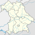
Файл:Bavaria location map.svg
Облик

Размер на този PNG предварителен преглед на изходния SVG файл: 608 × 600 пиксела. Други разделителни способности: 243 × 240 пиксела | 487 × 480 пиксела | 779 × 768 пиксела | 1038 × 1024 пиксела | 2077 × 2048 пиксела | 867 × 855 пиксела.
Оригинален файл (Файл във формат SVG, основен размер: 867 × 855 пиксела, големина на файла: 738 КБ)
История на файла
Избирането на дата/час ще покаже как е изглеждал файлът към онзи момент.
| Дата/Час | Миникартинка | Размер | Потребител | Коментар | |
|---|---|---|---|---|---|
| текуща | 17:22, 19 ноември 2009 |  | 867 × 855 (738 КБ) | Alexrk2 | fixed boundaries, rivers; adjusted map projection; colors for internal divisions |
| 20:01, 28 март 2009 |  | 867 × 855 (1,05 МБ) | TUBS | #corrected 4 mistakes (lake margins (pasted to foreground), RegBez and counties around TIR (splited area in two counties and corrected RegBez border), County of Munich (merged), Merged an (to me right know unknown) county north of Nuremberg. #moved all gr | |
| 09:32, 28 януари 2009 |  | 867 × 855 (1,45 МБ) | TUBS | {{Information |Description= |Source= |Date= |Author= |Permission= |other_versions= }} | |
| 00:20, 28 януари 2009 |  | 867 × 855 (1,45 МБ) | TUBS | {{Information |Description= |Source= |Date= |Author= |Permission= |other_versions= }} | |
| 00:11, 27 януари 2009 |  | 867 × 855 (1,46 МБ) | TUBS | {{Information |Description= |Source= |Date= |Author= |Permission= |other_versions= }} | |
| 23:20, 26 януари 2009 |  | 867 × 855 (1,5 МБ) | TUBS | {{Information |Description= |Source= |Date= |Author= |Permission= |other_versions= }} | |
| 11:38, 26 януари 2009 |  | 867 × 855 (1,51 МБ) | TUBS | == Summary == {{Information |Description= {{de|Positionskarte Hessen, Deutschland. Geographische Begrenzung der Karte:}} {{en|Location map Bavaria, Germany. Geographic limits of the map:}} * N: 50.6303000° N * S: 47.26618 | |
| 11:24, 26 януари 2009 |  | 867 × 855 (1,52 МБ) | TUBS | == Summary == {{Information |Description= {{de|Positionskarte Hessen, Deutschland. Geographische Begrenzung der Karte:}} {{en|Location map Bavaria, Germany. Geographic limits of the map:}} * N: 50.6303000° N * S: 47.26618 |
Използване на файла
Следната страница използва следния файл:
Глобално използване на файл
Този файл се използва от следните други уикита:
- Употреба в af.wikipedia.org
- Употреба в als.wikipedia.org
- Употреба в ar.wikipedia.org
- Употреба в ast.wikipedia.org
- Употреба в azb.wikipedia.org
Преглед на глобалната употреба на файла.


