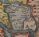
Файл:1580 Zelandicarum v Deventer.jpg
Облик

Размер на този преглед: 800 × 591 пиксела. Други разделителни способности: 320 × 237 пиксела | 640 × 473 пиксела | 1024 × 757 пиксела | 1280 × 946 пиксела | 2666 × 1971 пиксела.
Оригинален файл (2666 × 1971 пиксела, големина на файла: 1,71 МБ, MIME-тип: image/jpeg)
История на файла
Избирането на дата/час ще покаже как е изглеждал файлът към онзи момент.
| Дата/Час | Миникартинка | Размер | Потребител | Коментар | |
|---|---|---|---|---|---|
| текуща | 21:57, 2 декември 2007 |  | 2666 × 1971 (1,71 МБ) | Joopr | {{Information |Description=title=Zelandicarum Insularum Exactissima Et Nova Descriptio, Auctore D. Iacobo A Daventria;size=34x47cm |Source=http://www.orteliusmaps.com/stocklists/12.html |Date=1580 |Author=Ortelius naar v Deventer |Permission= |other_versi |
Използване на файла
Следната страница използва следния файл:
Глобално използване на файл
Този файл се използва от следните други уикита:
- Употреба в af.wikipedia.org
- Употреба в arz.wikipedia.org
- Употреба в crh.wikipedia.org
- Употреба в cv.wikipedia.org
- Употреба в de.wikipedia.org
- Употреба в en.wikipedia.org
- Употреба в es.wikipedia.org
- Употреба в et.wikipedia.org
- Употреба в fr.wikipedia.org
- Употреба в fy.wikipedia.org
- Употреба в he.wikipedia.org
- Употреба в hu.wikipedia.org
- Употреба в id.wikipedia.org
- Употреба в incubator.wikimedia.org
- Употреба в it.wikipedia.org
- Употреба в ko.wikipedia.org
- Употреба в lbe.wikipedia.org
- Употреба в lb.wikipedia.org
- Употреба в mk.wikipedia.org
- Употреба в mwl.wikipedia.org
- Употреба в nl.wikipedia.org
- Употреба в no.wikipedia.org
- Употреба в os.wikipedia.org
- Употреба в pl.wikipedia.org
- Употреба в pt.wikipedia.org
- Употреба в ro.wikipedia.org
- Употреба в ru.wikipedia.org
- Употреба в ru.wikinews.org
- Употреба в sah.wikipedia.org
- Употреба в scn.wikipedia.org
Преглед на глобалната употреба на файла.


